Findhorn, Nairn and Lossie Rivers Trust
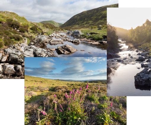
The River Nairn, located in the Scottish Highlands south and east of Inverness, flows through mountains, moorland and farmland to the Moray Firth, approximately 36 miles away. It is an essentially rural river, with the largest settlement, Nairn (pop. 8,600), at the river mouth.
The word ‘Nairn’ is from the Gaelic Uisge-Nearn, ‘the river of alders,’ and many of the banks in the middle reaches are shaded by these beautiful trees. The River Nairn arises near Carn Ghriogair in the Monadhliath Mountains at approximately 800m above sea level. As it flows mainly northeast out to the Moray Firth, it passes through Strathnairn and past Culloden Moor, site of the famous battle of 1746. The main tributaries are the River Brin, River Farnack, Craggie Burn and Cawdor Burn although there are several other smaller burns. Loch Duntelchaig is the only major loch draining into the Nairn although some smaller still waters are present. Loch Duntelchaig is also used for public water supply.